
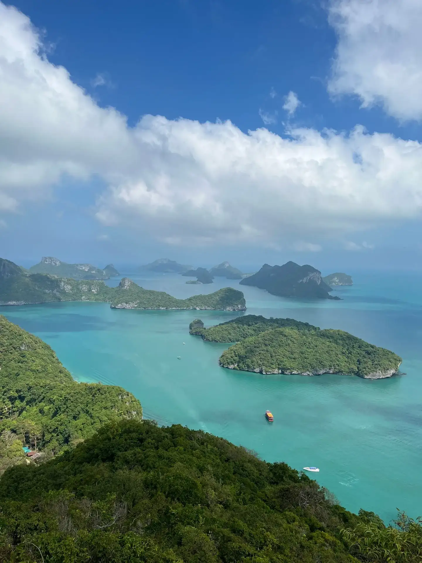
- Ang Thong means "bowl of gold" in Thai, a name given when the park was established on 12 November 1980.
- The name is usually linked to the ring-shaped cliffs of Koh Mae Ko that hold the Emerald Lake like gold in a bowl.
- Wua Ta Lap means "sleeping cow", Mae Ko means "mother island", and Sam Sao is known for its stone arch.
- The park covers about 102 km² and 42 islands, with people living only on Koh Phaluai and Koh Wua Ta Lap.
- Knowing the names helps on the day: most tours stop at Mae Ko and Wua Ta Lap, the two islands behind the story.
Somewhere between the coral stop and the stairway up to the Emerald Lake, someone on the boat always asks what "Ang Thong" actually means. It is a fair question to ask with a packed lunch in your hand and islands going past on both sides, so here is the ang thong meaning in plain terms, plus what the other names on the map are telling you.
What does "Ang Thong" mean?
Ang Thong (อ่างทอง) means "bowl of gold" in Thai. It is a name, not a description of the water or the sand, so do not expect anything literally gold-coloured on the trip.
The park took this name when it was established as a national park on 12 November 1980. It sits in the Gulf of Thailand, Surat Thani province, about 28 km west of Koh Samui, and covers 42 islands scattered across roughly 102 km² of sea.
There is also a province called Ang Thong in central Thailand, inland and nowhere near the sea, so if you search the name online make sure you are reading about the marine park and not the province. The two share a name and nothing else, not even the same part of the country.
Where does the "bowl of gold" story come from?
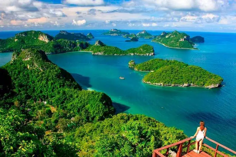
The story most guides tell links the name to the shape of Koh Mae Ko, the island with the Emerald Lake inside it. Seen from above, the limestone walls of Mae Ko form a rough ring around the lake, like the sides of a bowl holding something precious in the middle.
Whether the "gold" refers to the lake's colour, to the islands scattered like coins across the sea, or simply to the value the old fishing communities placed on this sheltered water, nobody can say for certain. Thai folk names often work this way: part geography, part poetry, agreed on by people long before anyone wrote it down.
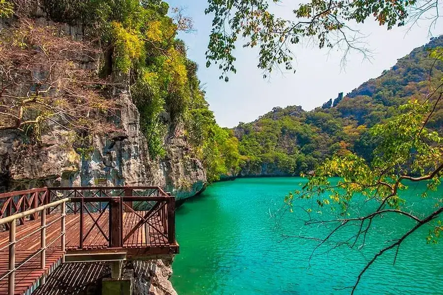
There is a second legend attached to the same island: some locals say the Emerald Lake sits in the mouth of a sleeping volcano. Geologically this is limestone, shaped by water and time rather than lava, but the story fits the place well enough that it keeps getting told, especially once you have climbed the stairs and are looking down into that green water yourself.
None of this changes anything about how you experience the park on the day. It is simply good to have in your head while the boat is moving between islands, because it explains why so much of the trip is built around two particular stops rather than spread evenly across all 42.
How the Emerald Lake connects to the name
The Emerald Lake, or Thale Nai, is the detail that makes the "bowl" story stick. It is a saltwater lagoon locked inside Mae Ko's cliffs, connected to the open sea only through tunnels under the rock, so the water level moves with the tide but you never see where it comes in.
You reach it by a short, steep stairway with handrails, and swimming in the lake itself is not allowed, so all you do here is look down from the platform at the top. It is still worth the climb: the green colour against the grey rock is the single most photographed view of Ang Thong after the main viewpoint on Wua Ta Lap.
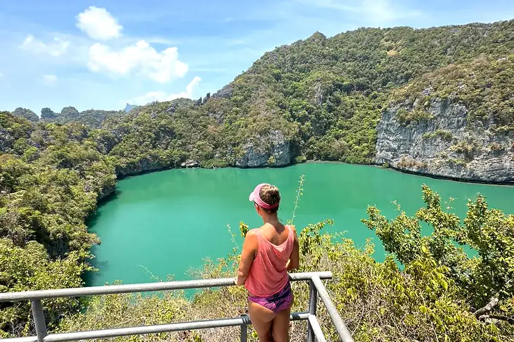
Local legend also calls Mae Ko the "mother island", and some people connect the two stories: a mother island cradling a lake the colour of jade inside a bowl of golden cliffs. It is a nice image whether or not it is the literal origin of the park's name.
Every group tour on this site stops at Mae Ko, usually for 30 to 45 minutes, which is enough time for the stairs, a few photos and the walk back down. For the full detail on how the lake works, why the water level changes and why you cannot get in, the dedicated guide to the Emerald Lake covers it properly.
What do the other island names mean?
Ang Thong is not one bowl of gold, it is 42 islands, and several of the bigger ones have names worth knowing before you go. They tend to describe a shape or a story rather than anything grand, which is fairly typical of how Thai fishing communities named the coastline long before any tourist boat turned up.
- Koh Mae Ko, "mother island": home to the Emerald Lake, and the island the whole park name is most often said to come from.
- Koh Wua Ta Lap, "sleeping cow": the park headquarters, named for the shape of the island from the water, with a restaurant, bungalows and the steepest viewpoint climb in the park.
- Koh Sam Sao: often called Tripod Island in English, best known for a natural stone arch that curves out of the cliff into the sea, and a favourite kayaking spot.
- Koh Phaluai: the largest island in the park and the only one with a real village, home to a small fishing community in the south while the north stays forested and protected.
None of these names are marked on signposts around the islands, so most visitors only learn them from a guide or from reading ahead, which is half the fun of a trip like this. Knowing that Wua Ta Lap means "sleeping cow" before you arrive makes the climb up its viewpoint feel a little less random, and knowing Mae Ko means "mother island" adds something to the moment you look down at the lake inside it.
Koh Wua Ta Lap: why "sleeping cow"?
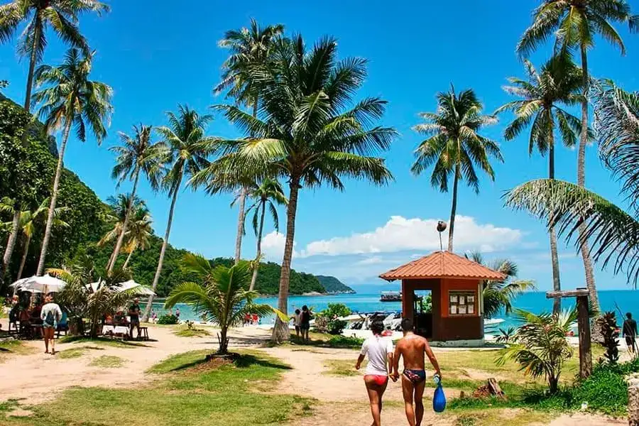
Wua Ta Lap means "sleeping cow" and refers to the outline of the island when you see it from a distance on the water, its low humped shape supposedly resembling a cow lying down. It is the park headquarters, so it carries more infrastructure than any other island: a ranger station, a restaurant, bungalows and a campsite.
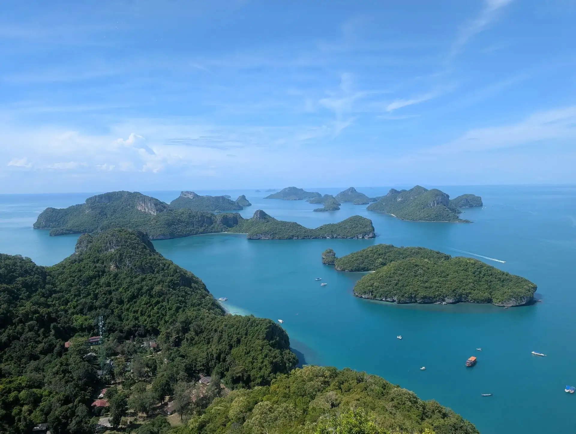
It is also where the hardest climb in the park happens. The trail to the top viewpoint is about 500 meters, steep and partly over rock, and it rewards you with the view over the whole archipelago that ends up on most people's phone as the cover photo of the trip.
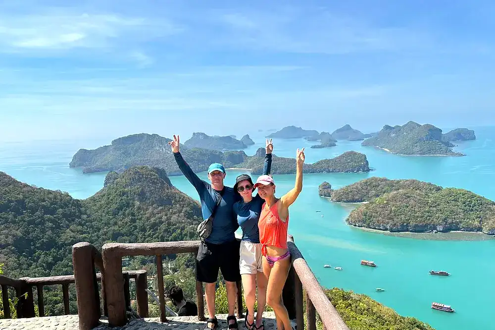
Families of dusky langurs live in the trees behind the headquarters beach, and a path leads to Bua Bok cave with its lotus-shaped stalactites. The beach itself is one of the better swimming spots in the park, with calm, clear water and enough shade to sit out the hottest part of the day if the climb is not for you.
If you want the full picture of what the island offers beyond the name, the Koh Wua Ta Lap guide goes through the trail, the beach and the cave in detail, including how long to budget for the climb and back.
Does the shape of the islands match the "bowl" idea?
Loosely, yes. Ang Thong covers about 102 km² of the Gulf of Thailand, and the 42 limestone islands sit close together in a rough cluster, which from a high viewpoint or a plane window does look something like scattered pieces inside a rim of water.
Geologically these are old limestone formations, shaped by rain and sea over a very long time, the same process that carved the Emerald Lake's tunnels and the arch at Koh Sam Sao. The average water depth around the islands is only about 10 meters, shallow enough that from above the whole park reads as one connected shape rather than 42 separate dots.
For a full rundown of which islands you actually see on a tour and which ones you only pass by boat on the way between stops, the article on Ang Thong islands and which ones you see is the better read, since most tours visit a handful of the 42 rather than all of them.
Which tour actually takes you to the islands behind the name
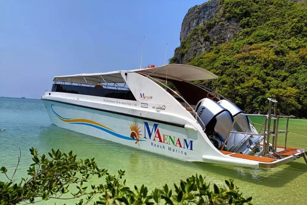
If the names and the legend are what pulled you in, Mae Ko and Wua Ta Lap are the two islands to prioritise, and nearly every tour stops at both. The speedboat tour is the most efficient way to see them both in one day, with the Emerald Lake and the viewpoint plus two more stops for snorkeling and a beach lunch, all for ฿1890 per adult with the park fee paid separately.
If you would rather go slowly and not worry about working anything out once you are on the water, the VIP speedboat tour keeps the group to a maximum of 16 and already includes the park fee, breakfast and lunch in one price. It also adds Koh Sam Sao and its arch to the day, so you get a third named island into the mix.
The Red Baron sailing cruise suits people who want the day itself to feel like part of the experience, moving between Mae Ko and Wua Ta Lap under red sails rather than racing between stops. And if you would rather set your own pace entirely, the private speedboat charter lets you decide how long to spend at each island, which matters if you want to linger at the Emerald Lake viewpoint longer than a group schedule allows.
Good to know before you book
A few practical points connect directly to what you have just read about the islands and their names.
| Detail | What it means for your day |
|---|---|
| Park fee | ฿300 per adult, ฿150 per child, paid in cash unless your tour already includes it |
| Swimming in the Emerald Lake | Not allowed, you view it only from the platform above |
| Wua Ta Lap viewpoint | About 500 meters, steep, optional if you would rather stay on the beach |
| Annual closure | Usually 1 November to 15 December every year, no tours run |
For the mechanics of getting there at all (there is no public ferry, only tour boats and private charters), the how to get there guide covers the piers, crossing times and pickup arrangements. And if you are still deciding what Ang Thong is as a whole before picking a tour, the first-timer's guide to the park is a good place to start before you commit to a date.
Booking itself is simple and free to start: a request on the site does not take payment, a manager confirms details by WhatsApp or email and sends a payment link afterwards, with the balance due on the day. The terms and conditions and cancellation policy are worth a quick read if your travel dates are tight around the annual closure or you are booking a long way in advance.
Questions and answers
Is Ang Thong a place name or does it have a deeper meaning?
It is both. "Ang Thong" is the official name of the national marine park, and it translates literally as "bowl of gold" in Thai, a name tied to local legend rather than any mineral in the ground or water.
Is Ang Thong National Marine Park the same as Ang Thong province?
No, they share a name but nothing else. Ang Thong province is inland in central Thailand, while Mu Ko Ang Thong National Marine Park is a group of 42 islands in the Gulf of Thailand near Koh Samui.
Why is the Emerald Lake connected to the "bowl of gold" story?
The lake sits inside a near-complete ring of limestone cliffs on Koh Mae Ko, which looks like a bowl holding the water, and many people believe this shape is where the park's name comes from. It is a popular explanation rather than a confirmed historical fact.
What does Koh Wua Ta Lap mean?
It means "sleeping cow", a name based on the outline of the island as seen from the water. It is also the park headquarters, with the steepest viewpoint trail in Ang Thong.
Can you visit every island with a meaningful name in one day?
Not all of them, but the ones with the best-known stories, Mae Ko and Wua Ta Lap, are on nearly every group tour. Koh Sam Sao and Koh Phaluai appear mainly on the VIP speedboat and private tours.
Does the name Ang Thong appear anywhere on the islands themselves?
No signage spells out the meaning on site. It is something guides explain on the boat or guests read about beforehand, which is really the only way to learn it.
Is there an official historical record of why the park got this name?
There is no single documented source that confirms the exact reasoning, only the commonly repeated legend about the lake and the bowl-like cliffs. It is worth treating it as folklore rather than settled history.
Does learning the island names change how I should plan my tour?
Not really, since the tours are built around the same highlights regardless of what you call them. It mostly adds context to stops you were visiting anyway, particularly Mae Ko and Wua Ta Lap.
Facts checked against our tour pages on 18 October 2026. Prices and days can change: your manager confirms them when you book.