- The 42 islands of Ang Thong are mostly limestone, rock built from the shells and skeletons of sea creatures and later dissolved and carved by rain and waves.
- Rainwater is slightly acidic, so over a very long time it widened cracks in the limestone into steep cliffs, towers and caves.
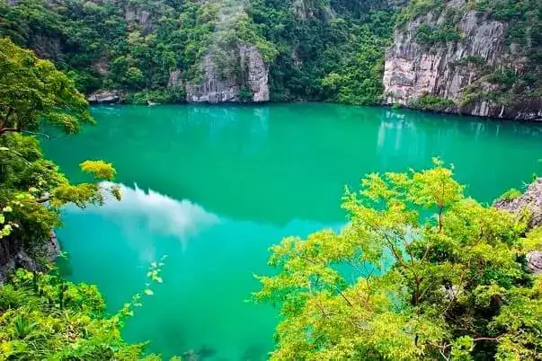
- The Emerald Lake on Mae Ko is a saltwater lake inside the island, joined to the sea through underground tunnels, and swimming in it is not allowed.
- Bua Bok cave on Wua Ta Lap has stalactites shaped like lotus flowers, grown drop by drop from water carrying dissolved limestone.
- Every group tour stops at Mae Ko and Wua Ta Lap, and the VIP speedboat tour kayaks along Koh Sam Sao with its natural rock arch.
The speedboat slows, the engines drop to a murmur, and a grey wall of rock rises straight out of green water a few metres from the hull. People reach for their phones, and someone always asks the same thing: how did these rocks get here? This article answers it in plain words, because the ang thong limestone islands make far more sense once you know what you are looking at.
No exam at the end, I promise. Just enough geology to turn "nice cliffs" into a story you can read in every wall, cave and overhang on the day.
What are the Ang Thong limestone islands made of?
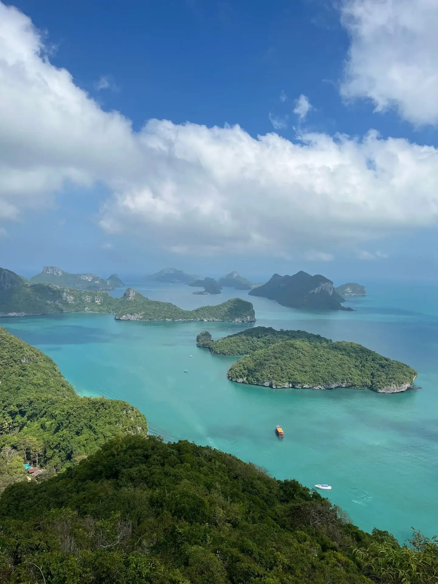
They are made mostly of limestone, a rock that began as the shells, corals and skeletons of sea creatures piling up on the floor of an ancient shallow sea. Over an enormous span of time that layer was pressed into stone, lifted by the movements of the earth, and then worn down into the 42 islands of Mu Ko Ang Thong National Marine Park that you see today.
Limestone is mainly calcium carbonate, the same stuff as chalk and seashells. It is hard enough to stand in vertical cliffs, but it has one weakness that explains almost everything in the park: it slowly dissolves in water.
Geologists call a landscape shaped this way karst. You find it across southern Thailand, and Ang Thong is a compact, easy-to-visit piece of it, about 28 km west of Koh Samui.
How did rain carve the cliffs and towers?
Rain did most of the carving. Rainwater picks up a little carbon dioxide from the air and the soil and becomes a very weak acid, and that weak acid dissolves limestone along every crack, a fraction of a millimetre at a time.
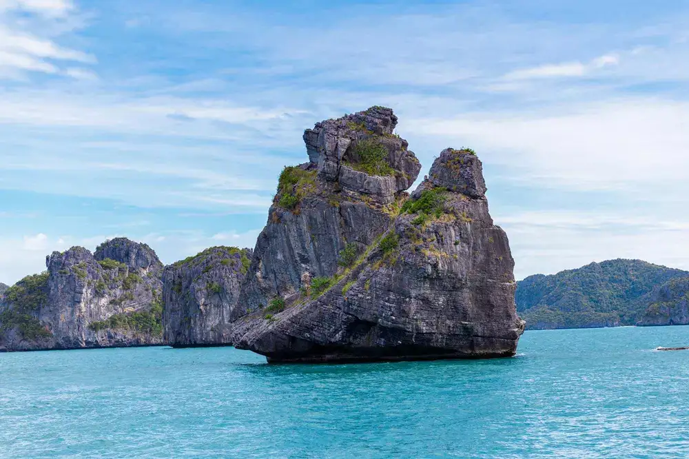
The rock is full of cracks and layers. Water finds them, widens them, and over a very long time the cracks become gullies and the blocks between them become towers. That is why the islands have sheer walls and sharp tops instead of the gentle slopes of granite hills.
Up close, the surface is rough and full of little blades and pits. It looks solid, and it is, but it is also sharp: on the Wua Ta Lap trail you will be glad of shoes with grip and of the ropes and rails on the steep parts.
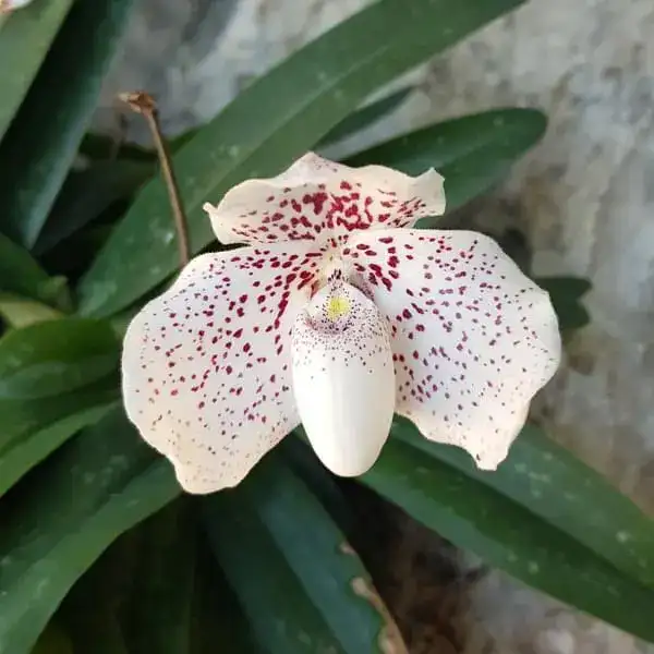
The jungle on top is a clue too. Soil collects only in pockets and on ledges, so trees grip the rock with long roots. One rare plant thrives exactly here: the Ang Thong lady's slipper orchid, which grows on the limestone cliffs of Wua Ta Lap, Phaluai, Mae Ko and Sam Sao.
Why are the islands standing in the sea?
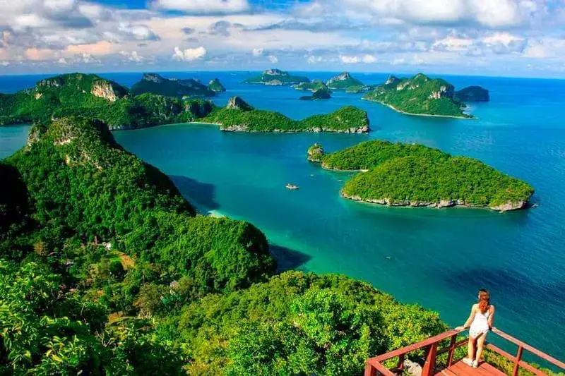
Because the sea rose around them. During the last ice age so much water was locked in ice that sea level was far lower, and much of the Gulf of Thailand was dry land; when the ice melted, the sea flooded the lowlands and the limestone hills became islands.
The water in the park is still shallow, with an average depth of around 10 m. On a calm day you can picture it: the islands are the tops of a hilly landscape, and you are boating over what used to be valleys.
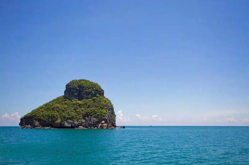
This also explains why the islands are so close together and why the channels between them are calm in the dry season. It is a drowned hill country, not a chain of volcanoes or reefs.
What carved the notches, caves and the rock arch?
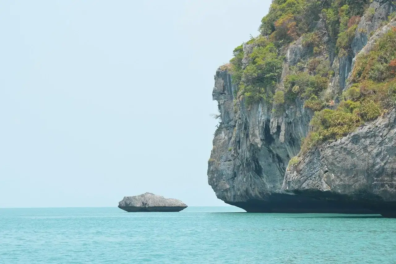
Where rain works from above, the sea works from the side. Waves, salt and the tiny creatures that bore into rock eat away at the cliff foot, cutting a deep notch along the waterline that you can see on almost every island from the boat.
As the notch deepens, the rock above it overhangs. Weak spots become sea caves, and when a cave cuts right through a narrow point of rock, you get an arch. The famous example is on Koh Sam Sao, where a natural stone arch curves out of the cliff into the sea.
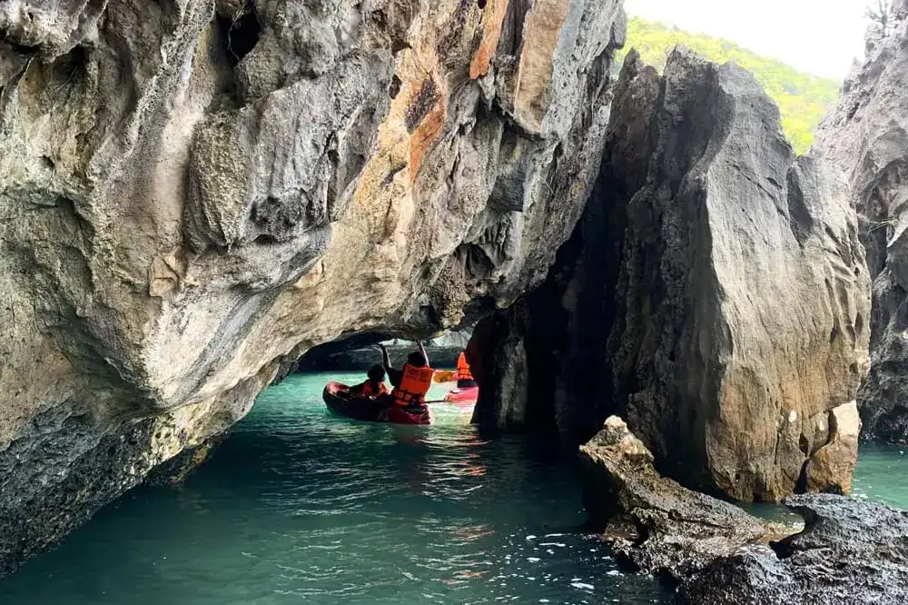
The arch is one of the classic photos of Ang Thong. On the VIP speedboat tour you kayak along Koh Sam Sao, and kayaks can pass close under the arch on a quiet day; on the other tours you usually see Sam Sao from the boat between stops. There is more on that route in the article about the Koh Sam Sao arch and its kayak route.
My opinion: if the geology grabs you, the kayak is worth more than any viewpoint. From a kayak the notch is at eye level, and you can see the rock layers, the overhangs and the dark mouths of small caves that the big boats pass at a distance. The kayaking guide lists where each tour paddles.
What is inside Bua Bok cave on Wua Ta Lap?
Bua Bok is a cave behind the beach on Koh Wua Ta Lap, the park headquarters, and it is known for stalactites shaped like lotus flowers, which is where the name comes from (bua is the Thai word for lotus).
Caves like this are the other half of the limestone story. Rainwater that dissolved rock higher up drips through the ceiling, and each drop leaves behind a tiny ring of calcite as it loses carbon dioxide into the cave air. Ring after ring, the drips build stalactites hanging down, and where drops land on the floor they build stalagmites growing up.
The process is extremely slow, which is why I ask everyone the same thing inside: please do not touch the formations. Skin oil and dirt stop the mineral from settling, and a broken stalactite does not grow back in any human lifetime.
On the speedboat tour the cave is one of three choices at Wua Ta Lap, along with the viewpoint trail and the beach. On the big boat you can also look into it. The Koh Wua Ta Lap guide covers the island, the trail and the beach.
How did the Emerald Lake end up inside Mae Ko?
The Emerald Lake, Thale Nai, sits in a hollow inside the limestone walls of Mae Ko and is connected to the open sea only through underground tunnels, so it rises and falls with the tide while you never see the opening.
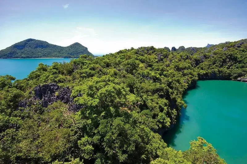
The most likely story is a classic karst one. Water dissolved a large cavity inside the rock, the roof gave way over time and left a deep hollow, and when the sea rose it seeped in through cracks and tunnels and filled it. Geologists call such a hollow a sinkhole or doline.
A local legend says the lake sits in the mouth of a sleeping volcano. Geologically it is limestone, but stand on the platform and you will see why people thought so: the lake looks like a crater filled with green water.
Swimming in the lake is not allowed, to protect it. If you want to know where the colour comes from, read why the Emerald Lake is green.
Where can you see the geology on each tour?
Every group tour shows you the two big features, the Emerald Lake on Mae Ko and the view over the karst islands from Wua Ta Lap; what differs is the cave, the arch and how close you get to the cliffs.
| Feature | Where | On which tours |
|---|---|---|
| Emerald Lake (sinkhole lake) | Koh Mae Ko | Speedboat, VIP speedboat, big boat, Red Baron; usual route on a private charter |
| View over the limestone towers | Wua Ta Lap viewpoint, about 500 m steep trail | Speedboat, VIP speedboat, big boat, Red Baron |
| Stalactites of Bua Bok cave | Behind the beach on Wua Ta Lap | Speedboat (instead of the trail or the beach), big boat |
| Natural rock arch | Koh Sam Sao | VIP speedboat (kayaking); seen from the boat on other tours |
| Cliffs, notches and small sea caves by kayak | Tamarin Beach, Sam Sao, Mae Ko | Speedboat (included), VIP (included), big boat (kayak option) |
For the most rock per hour, the VIP speedboat is the best fit, with the Sam Sao kayak route and two viewpoints. The regular speedboat is the good-value choice, with cliffs by kayak and the cave as an option. The big boat suits people who want an easy pace and the cave without the bumps, and the Red Baron is for those who would rather watch the cliffs pass from a deck.
Tips for looking at the rocks on the day
You do not need a guidebook, just a little attention and the right timing. The park is usually closed every year from 1 November to 15 December, and from January to September the sea is usually calm, which is when kayaking along the cliffs is easiest.
- Look at the waterline: the notch shows how hard the sea works on the rock.
- Look for vertical grooves on the cliffs: those are rain channels.
- In the cave, let your eyes adjust and do not touch the formations.
- On the trail, wear shoes with grip: limestone is sharp and slippery when wet.
- Do not take stones or bits of stalactite home; leave the rock where it is.
Bring water for the climbs, a waterproof pouch if you kayak, and a hat. The best geology lesson in Ang Thong is free: sit in the boat on the way out, look at the cliffs, and spot the notch, the grooves and the caves for yourself.
Questions and answers
Are all the Ang Thong islands limestone?
The islands of Ang Thong are known as limestone islands, and limestone shapes the cliffs, caves and the Emerald Lake you see on the tours. The steep walls, sharp tops and caves are all typical of limestone worn down by rain and sea.
Is the Emerald Lake a volcano crater?
No. A local legend says it sits in the mouth of a sleeping volcano, but Mae Ko is limestone. The lake is most likely a collapsed hollow in the rock that the sea filled through underground tunnels.
Can you go inside Bua Bok cave on a day tour?
Yes, on the speedboat tour the cave is one of the choices at Wua Ta Lap, along with the viewpoint trail and the beach, and on the big boat you can look into it as well. Ask the guide on the day how much time there is.
Can you kayak under the Sam Sao arch?
On the VIP speedboat tour you kayak along Koh Sam Sao, and on a quiet day kayaks can pass close under the arch. The captain and guide decide what is safe in the conditions.
Why is the rock on the islands so sharp?
Rainwater dissolves limestone unevenly, leaving little ridges, blades and pits on the surface. It is rough on hands and feet, so wear shoes with grip on the trails.
How old are the Ang Thong islands?
The limestone itself is very old, built up on an ancient sea floor long before people existed. The islands as islands are much younger: they became separate when sea level rose after the last ice age and flooded the lower ground.
Do I need to pay extra to see the caves and the lake?
They are inside the national park, so the park fee covers them: ฿300 per adult and ฿150 per child. It is already included in the VIP speedboat and Red Baron prices.
Facts checked against our tour pages on 3 November 2026. Prices and days can change: your manager confirms them when you book.